This past weekend we drove to Switzerland for a little hike with Martin's sister, Mareika, who is visiting us from Cape Verde. Our Swiss friend Nico planned a hike for us and was our guide. So, this is another challenging Nico hike. I'm not sure why we continue to hike with him because we're always in so much pain the following day. But it always feels so good to see what you accomplished once you've finished the hike and Niko always makes sure we are pushed to our limits.
We hiked Engelberger Rotstock which is on the border of the Kantons Uri and Nidwalden. It is a little over 2800 meters high and our hike began around 1700m. We hiked about 10 miles with 1100m of elevation gain and 1200m of elevation loss throughout the hike. It was 7 hours of hiking, plus breaks for lunch and an afternoon beer at the usual random restaurant in the middle of the Alps.
In the beginning of the hike we walked through pretty Alpine meadows where there were lots of cows. They liked resting in the middle of the trail so we had to walk around them. Of course the Swiss people on the trail behind us just shoved the cows out of the way and walked through them but we weren't that brave. We also got a nice view of a lake once we got a little higher up.
The first picture below is of Mareika being excited about some cows and the second picture is of the three guys, getting way ahead of us ladies as usual. The third guy is Roman, a French intern at the ETH.

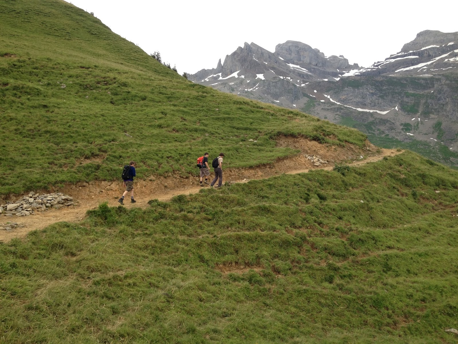
Below left is the little lake and below right are the guys walking around some cows:


Ignore Martin's frown below - he was told not to smile because sometimes he oversmiles. But here we are at the top of the first pass:

After the Alpine meadows we hit some snow fields. Mareika, living in Cape Verde, hasn't seen snow in several years, so she's pretty excited. As you can see, some of the snow fields were pretty steep! The second to last pic is Mareika and I maneuvering our way up to the top of a particularly challenging one and the last pic is Mareika finally at the top:


The guys waiting for Mareika and I to get up the snowy slope:

Then we walked across lots of loose rocks and snow. The first pic shows me wondering if I'm going to make it to the top or not, and the second pic is of me and Mareika along the same stretch but on the way back down. I know it looks like there's a nice trail here but in reality it's just slippery rocks that slide under your feet:


Then we started to climb up to the top of the mountain. The top was very steep, slippery, loose rocks, but we all made it up. Here we are at the top (and Garmisch too of course!):


Then we had to get down the steep slippery rock slope! Not a lot of fun but we all made it. Here are Mareika and Martin on the slope:


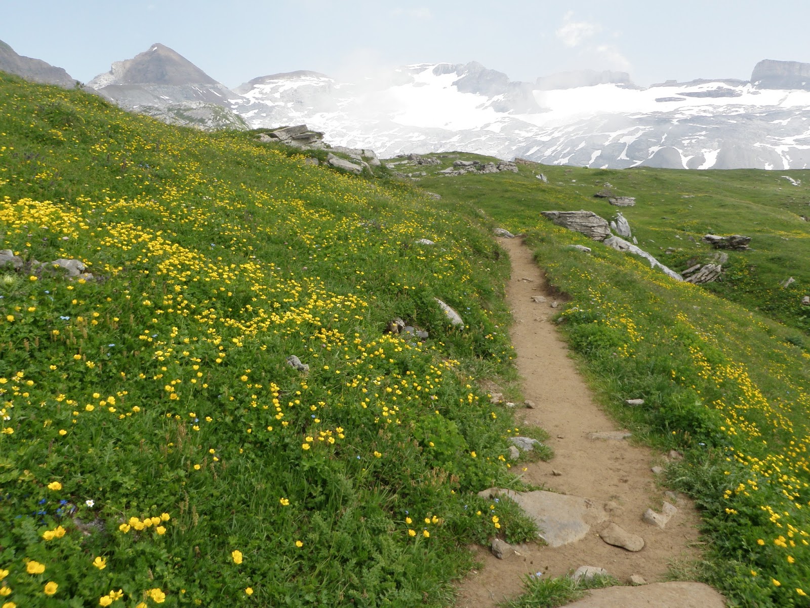
After this we got to walk through some gorgeous Alpine meadows with good views:

The mountain with the reddish top behind Mareika in the picture to the right below is what we hiked up! Look how far down we've already come!

Here are four of us, excited to be almost to the hut ...

Where we found some beer! Garmisch too of course. And yes we are in the middle of a cloud in this picture, hence the completely white background. It's kind of neat to be in the clouds, or to see one coming at you then just enveloping you.

After we had our beers the rest of the hike is just a blur. Seriously though, it was another 2 hours of walking downhill through meadows with pretty wildflowers. Then we took a cable car down to Engelberg, walked 15 minutes to the train station, took a train back to our car, and drove 4 hours back to Bad Dürkheim. Kind of a long day!
And a picture of Mareika pointing to our destination when we were about halfway up. Nico made her take this pic so she would remember what she hiked.

No comments:
Post a Comment