Thursday, September 10, 2015

Dolomites Hiking: The Peitlerkofel


Our final hike in the Dolomites was to the top of the Peitlerkofel. The Peitlerkofel is 2,875m high and supposedly has amazing panoramic views from the top. I say supposedly because, when we climbed it, the top was in the clouds so we didn't get to see much of the view. The important thing is that we made it to the top!

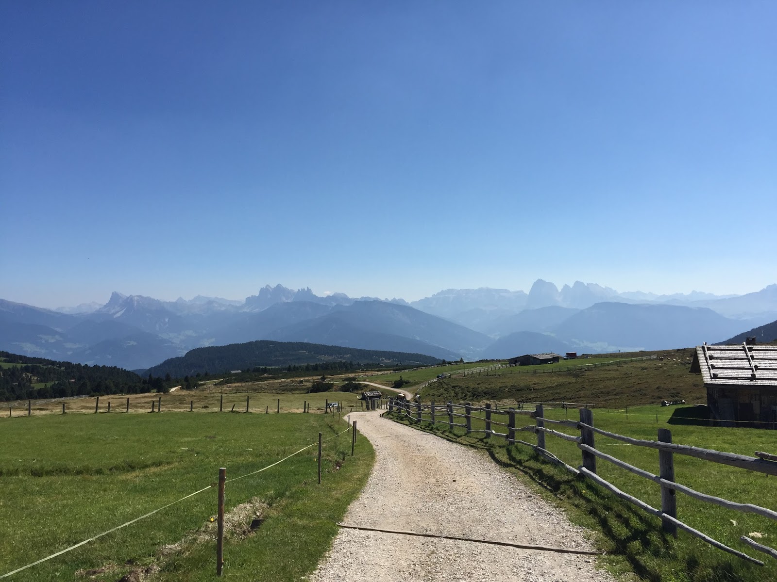
Here we are, just starting out the hike, looking towards the Peitlerkofel.


We were already above the fog in the valleys.


A few more views of the Peitlerkofel and the surrounding countryside as we wandered across a few meadows before we really started to climb.


This is taken from a little more than halfway up. Clouds kept rolling by, which was really neat.


Some pictures from the saddle between the big and little Peitlerkofel summits. Here is where you have to decide which peak to climb - the taller one, behind me in the picture below, is only about 50m taller.


View from the saddle. We started from down there!


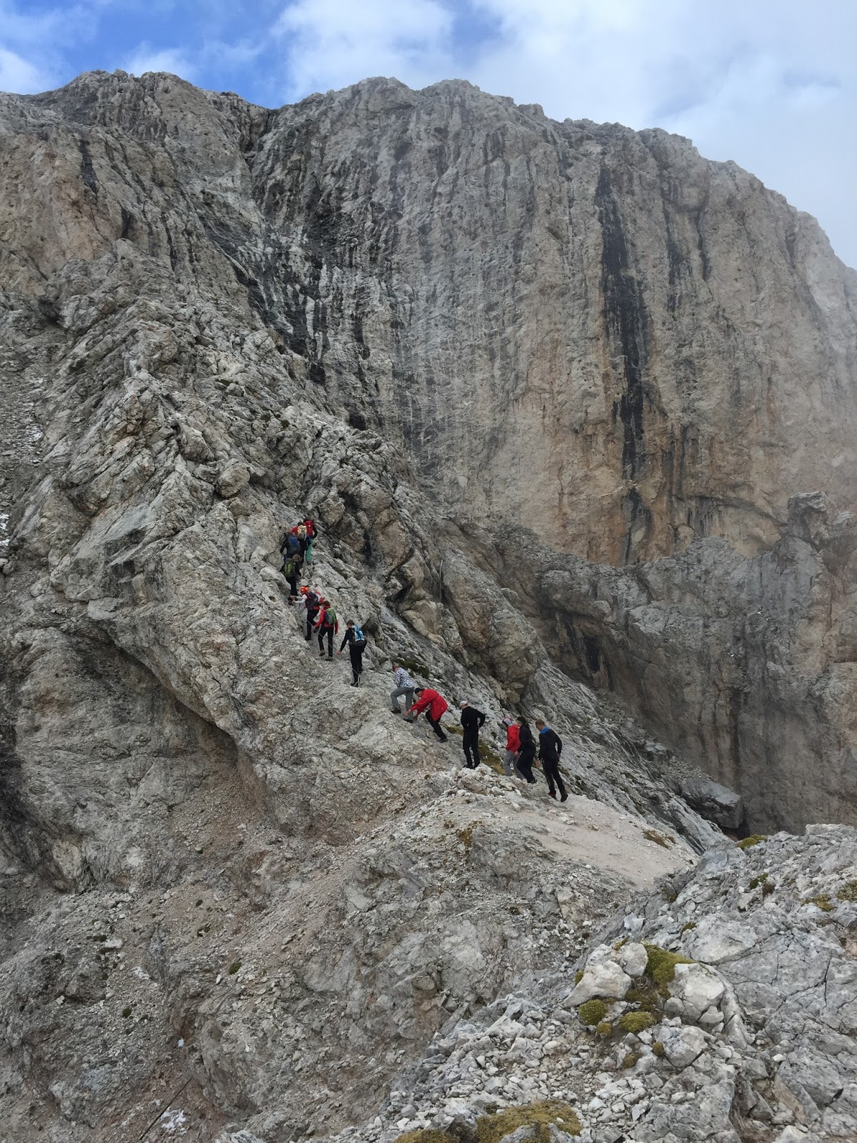
If you choose to climb the taller Peitlerkofel, then get your harness on and strap yourself onto the chains and pull yourself on up, like the group below is doing. Side note, their guide smoked the whole way up.


We actually summitted the smaller Peitlerkofel and not the really high one. It was cold, cloudy, and windy while we were up there. I already couldn't feel my hands. Here are some pictures from the smaller peak. Yes we were the only people there. This is supposedly one of the most popular hikes in the Dolomites, but we were maybe the third group to reach the top.


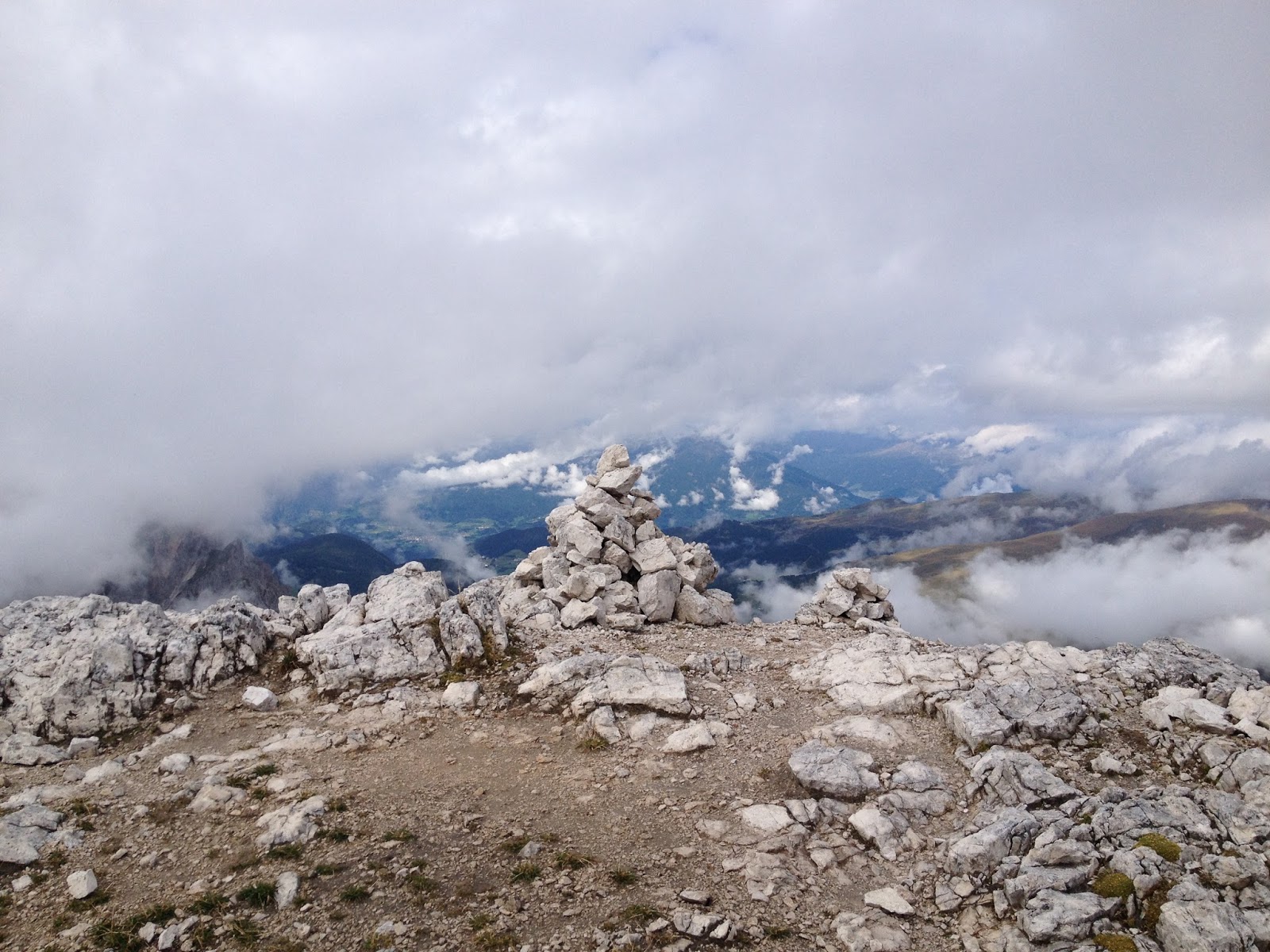
The taller peak, as seen from the smaller peak.


Wait, I'm not at the top yet. Here I come.


And now I'm heading back down. I spent a total of 1-2 minutes at the top - just long enough to take a few pictures and eat a cookie. It was cold.


Some views from the way down, when we had more time for pictures. On the way up we were worried about storms in the forecast but on the way down we didn't care anymore.


Our lunch break spot.


So, this upper part of the trail consists of really nice, gentle switchbacks. This is where all of our pictures were taken. The views are gorgeous anywhere on this upper part of the trail. The bottom half of the trail is more of a bleak, steep rock scramble up a ravine. It's not really that bad, but it's definitely not the nicer half of the trail. We should have taken a picture of it but didn't.


We stopped at a hut on our way down - it was basically at the bottom, about a 20 minute walk from where we had parked. They had shaggy cows there - and goats, geese, etc. Here we had hot chocolate (me) and coffee with schnapps (Martin). As the day went on, the Peitlerkofel had more and more clouds around it so we were glad we summitted when we did.


Some pictures from the drive back to our hotel. Martin really hated all of the steep, windy, narrow roads we had to drive on to get to the trailheads (not that I enjoyed them). However, from our experience, this is how all mountain roads in Italy are. If you want to hike, you have to be brave and drive on these one-car-wide roads, generally with steep dropoffs to one side and zero visibility around sharp turns.

Monday, September 7, 2015

Dolomites Hiking: Adolf Munkel Trail


I need to take a moment to say how amazing the hotel we stayed at in Velturno, Italy was. It's called the Taubers Unterwirt hotel, and it's an "active experience" hotel where they cater to hikers and cyclists and just outdoor enthusiasts in general. They have guided bike tours and hikes most days, plus other organized activities like pilates, castle tours, free cake set out every afternoon, a spa and sauna, etc. They also let you borrow any hiking materials you needed - hiking sticks, backpacks, etc. It was a great place but what made it really special was the friendliness, helpfulness, and knowledge of the staff. I re-injured my IT band during our first hike and so we needed a relatively easy hike for our third hike so I could rest my IT band a bit (we had originally planned a much more difficult hike for this day). So we went to the front desk and they gave us several options - including printouts describing the trail, how to get there, elevation profile, etc. They took all the hard work out of planning out this hike which was much needed because there are so many hikes in the area that we didn't have a chance of deciding which one to do.

There wasn't anything particularly special about the Adolf Munkel trail. There were a lot of people on it, it was mostly through the forest, and it was not particularly long or steep. Just a nice little hike. You do get a great view of a group of Dolomites every once in awhile through the trees, and there are two huts positioned in a meadow where you get an amazing view. Naturally, that's where we ate lunch and took a little break.

The start of the hike:


The lunch spot and the views from there:


We ordered Kaiserschmarr for lunch - it's basically pancakes, or maybe friend dough or somewhere in between, with some powdered sugar and some jam on the side. It's very popular in this region. When we saw somebody order it I had to have it for myself.


The lunchtime entertainment:


Our rest spot. There were a lot of chairs out here to relax on and enjoy the view - cows in a pasture just below us with Dolomites rising up right behind them. A really impressive view. I would do this hike again just to sit here again.


Hiking back down to where we started at Zanser Alm. We took a "gentle" route down to help my IT band out but it ended up in a good amount of uphill at the end of the hike, which wasn't very fun. No worries, you can take the non-gentle route (which just means it's rockier, narrower, and/or steeper than the nice road/trail we were walking on) and avoid doing any uphill on the way back.

Sunday, September 6, 2015

Dolomites Hiking: Alpe di Villandro Pasture


We declared our second day of hiking to be an "easy day" and so we headed to some alpine meadows near Villandro and wandered around in them. These meadows are at 1,800 - 2,000 meters elevation and give you a great view of some Dolomites in the distance. The trails are all wide and well-maintained, with gentle inclines and declines. You could push a stroller or a wheelchair on most of them.

Below are some pictures from the trails, the hut we stopped at for lunch, and us relaxing towards the end of the hike and just enjoying the view.


This is the hut we stopped at for lunch. We were served very large portions of pasta in a tomato cream sauce and cheese knödel in some butter and could barely move afterwards. The restaurant was run by a family, even their 10-year-old son was helping to bring out dishes to the tables, and at the end of the meal the father brought us inside and gave us free homemade schnapps (mine came out of an old coke bottle). People in this region sure do love sharing their schnapps, as we've learned over the years.


Here's Martin relaxing in a meadow with a great view:


After leaving this hike, we wandered around the village of Villandro a bit and hit the grocery store there. We found this enormous jar of nutella. When Martin picked it up an older woman told him it would make him fat, so we put it back. :)


On a side note, the flowers in this region were amazing. I don't know what all kind of flowers people had on all their balconies, but my flowers have never and will never look as good as everybody's in Südtirol did. The picture below doesn't even do the flowers justice. Some of the buildings we saw just had end-to-end explosions of flowers.