Our final hike in the Dolomites was to the top of the Peitlerkofel. The Peitlerkofel is 2,875m high and supposedly has amazing panoramic views from the top. I say supposedly because, when we climbed it, the top was in the clouds so we didn't get to see much of the view. The important thing is that we made it to the top!
Here we are, just starting out the hike, looking towards the Peitlerkofel.

We were already above the fog in the valleys.

A few more views of the Peitlerkofel and the surrounding countryside as we wandered across a few meadows before we really started to climb.


This is taken from a little more than halfway up. Clouds kept rolling by, which was really neat.

Some pictures from the saddle between the big and little Peitlerkofel summits. Here is where you have to decide which peak to climb - the taller one, behind me in the picture below, is only about 50m taller.

View from the saddle. We started from down there!

If you choose to climb the taller Peitlerkofel, then get your harness on and strap yourself onto the chains and pull yourself on up, like the group below is doing. Side note, their guide smoked the whole way up.

We actually summitted the smaller Peitlerkofel and not the really high one. It was cold, cloudy, and windy while we were up there. I already couldn't feel my hands. Here are some pictures from the smaller peak. Yes we were the only people there. This is supposedly one of the most popular hikes in the Dolomites, but we were maybe the third group to reach the top.


The taller peak, as seen from the smaller peak.

Wait, I'm not at the top yet. Here I come.

And now I'm heading back down. I spent a total of 1-2 minutes at the top - just long enough to take a few pictures and eat a cookie. It was cold.

Some views from the way down, when we had more time for pictures. On the way up we were worried about storms in the forecast but on the way down we didn't care anymore.


Our lunch break spot.


So, this upper part of the trail consists of really nice, gentle switchbacks. This is where all of our pictures were taken. The views are gorgeous anywhere on this upper part of the trail. The bottom half of the trail is more of a bleak, steep rock scramble up a ravine. It's not really that bad, but it's definitely not the nicer half of the trail. We should have taken a picture of it but didn't.


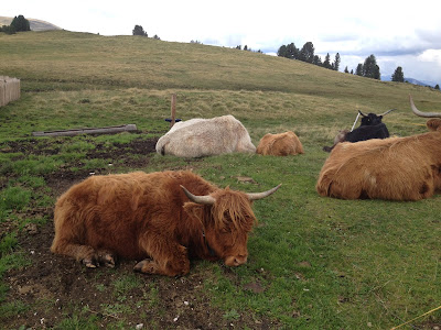
We stopped at a hut on our way down - it was basically at the bottom, about a 20 minute walk from where we had parked. They had shaggy cows there - and goats, geese, etc. Here we had hot chocolate (me) and coffee with schnapps (Martin). As the day went on, the Peitlerkofel had more and more clouds around it so we were glad we summitted when we did.


Some pictures from the drive back to our hotel. Martin really hated all of the steep, windy, narrow roads we had to drive on to get to the trailheads (not that I enjoyed them). However, from our experience, this is how all mountain roads in Italy are. If you want to hike, you have to be brave and drive on these one-car-wide roads, generally with steep dropoffs to one side and zero visibility around sharp turns.


No comments:
Post a Comment