Thursday, July 29, 2010
New Backpacks!
Here are our shiny new backpacks. Can you tell which one is mine? We treated ourselves to them at our favorite Swiss outdoor store, Bächli. I told the salesman there (who has family in Natick, small world) to find me something orange! Actually, a large number of the bags there were orange so it wasn't an issue.
I didn't have any sort of hiking backpack, so I needed one, and the backpack that Martin has been using here kills his shoulders and is not meant for hiking so it was time for something a little more serious for all of the hiking we plan to do here. So now we have our bags that we will use for our hiking trip this weekend!
I got Martin to agree to a less-intense hike in a valley on Saturday (though it's 18km), and then on Sunday we'll do a steeper hike. We really have no idea how difficult either of them will be so we'll see.
Sunday, July 25, 2010
A Little Sunday Hike
So, today being my day of rest from heavy exercise, I planned to go for a walk. Preferably in the woods behind our apartment and no further than 4 miles. So Martin lines up an 8-mile walk about an hour away and off we go. But we walk so much here that we barely feel an 8-mile walk anymore so it wasn't too big of a deal. I made sure to complain a good amount though.
It was a gorgeous afternoon, around 70 with sunny skies. The walk was mostly flat (except the bit with 224 stairs, yes I counted) and had great views of the Zürichsee. And it had a little bit of everything - sections through heavily forested areas, sections through residential neighborhoods where all the extremely rich people who have amazing views live, and sections through fields of corn and wheat. The beauty of the walk was that it was all well-marked with wide well-cared-for paths. There are so many miles of these hiking trails around Zürich I doubt we'll ever get to them all.
So here are the pictures:
A little pond with some ducks:
A little waterfall we wandered by:
The views from our lunch spot:
Martin unwrapping our sandwiches from the Pretzel King for our lunch. Because of course we made sure to pass by a Pretzel King on our way to start our walk so we could stock up on pretzel bread sandwiches.
Some fields of corn and wheat:
Martin made a friend. This is one of the friendliest cats we've seen here - she came running out of the field to greet us with her tail in the air and then just threw herself onto the ground in front of us and let us pet her.
And now I'm ready for a nap!
Monday, July 19, 2010
Golfing
Yesterday we went golfing with one of my friends from my German class, Agnes (from Singapore), and her fiance, Andreas (from Germany). They belong to a nice golf club about 45 minutes outside of Zürich so we went as their guests. Martin rented clubs and played 18 holes and I walked the first nine with them and then Agnes and I went into the clubhouse and had a drink while the men played the back 9. Had the prices been lower I would have rented some clubs and fooled around on the course with them but I just enjoyed the walk and being outdoors instead. It was a perfect day - mid 70's with just a few fair weather clouds in the sky. I didn't bring the good camera but I took a few pictures with our phone ... they're all sort of blurry but you get the idea. The golf course had amazing views of the Alps!
Martin lines up his putt while Agnes and Andreas look on:
Great views and a gorgeous day:
And here is the terrace where we ate dinner overlooking the 9th and 18th holes and the mountains to the south (which are not in this picture but to the left of it):
Thursday, July 15, 2010
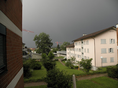
Thunderstorms!
Monday, July 12, 2010
My Morning Run
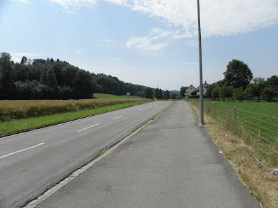
Here are some pictures from my current morning running route. I managed to find a nice flat rural-ish road surrounded by fields of wheat and corn.
These cows just appeared a few days ago. They like to hang out in the shade. Behind the cows is the forest that we can walk around in that I took pictures of a few weeks ago.
And across the street from the cows is a little barn with some horses in it. I didn't take a picture of the horses but you can see where the horse carrier car thing is.
A nice field of wheat. There is a path along the forest, between the forest and the wheat field. I plan to start running along that on occasion. Note that this forest is not the same forest as above - this forest is on the other side of the street. Try to keep track of all of the ruralness going on here in the outskirts of Zürich. We have found so far that any forested area in or near Zürich has nice, well-kept walking trails. It's quite nice.
And then I cross over the thruway! Some mornings, when rush hour traffic (6am is rush hour here because the Swiss get up crazy early) is bumper to bumper, I bet most of the people sitting in their cars wish they were me on a nice morning run across the bridge.
This is more of the forest that goes behind our apartment. It is actually quite extensive. It has great running trails and I'd run in it in the mornings but a) it's up an enormous hill from our apartment and my calves don't like that at 6am, and b) I couldn't handle being one of the first people to run in there in the early mornings because I'd have to break all the spider webs on the trails from the night before. It's really part b) that is keeping me from going in there.
Then I continue down this bit of sidewalk until I reach the buildings in the distance, then I turn around and come back or turn and run back along the forest a bit but there is only that one bridge over the thruway so I have to run back along that part of the road again.
So that's my route. It is exactly 5km (3.1 miles). Once I have more than a half hour to run in the mornings (so after my intensive German classes are done) I hope to extend my run a bit.
Sunday, July 11, 2010
Hiking From Rotondo Hütte Day Two
So on day two we all know that we're in for 6-8 hours of extremely challenging hiking. We start out from the hut and walk over a lot of rocks and around a big lake. First we come down some rocks:
Then we cross yet another stream (we must have crossed at least 30 of them), and then hike up some more snow and rocks. This area was different though because there was some mud in it! I'm the one in orange in these pictures:
This is Stefan. The guy with the map. He is standing next to a white-blue-white trail blaze (on one of the rocks, the blue color denoting that the hike is ranked in the most difficult category possible) and undoubtedly he has the next blaze in his sights. Behind him is the peak we're heading to. He led us and found our route for most of the hike, except when it got really difficult and then Mattias had to lead because he hangs out on cliffs and climbs rocks in his spare time.
This is Julian. He lent me the backpack that I used for this trip since Martin and I only had one hiking backpack here. We have a picture of him looking happier but I felt this one was more fitting to depict the hike:
This was the scariest part for me - walking across this snow field. You can't really see our foot tracks but we did not walk where the slope was gentle towards the bottom. We were sure somebody would fall but only one person slipped a good amount and he managed to get back up. Phew.
After that snow field we wandered over a lot of loose rocks on a really steep slope and we obviously did not take any pictures of that. But please refer to the picture of the Hut from Day One to see the ridge we were trying to climb up and you'll get the idea.
Here's Martin taking a little break:
I feel that this picture of Erick sums up the hike really well ... it shows somebody pushed to his limits and overcoming them to continue on and finish the hike:
Our snack spot when we were almost to the top. We are looking down the other side of the ridge now! The woman in this picture is Karin. She is French and is the only woman in Martin's group:
More of the view from our snack spot:
Then we did some more scary stuff along the ridge at the top. Some of it involved having to hold on to chains because the path was so narrow and falling off would lead to death. Then we got to start coming down! We came down 1200 meters straight. Here's some of what we walked down:
Here we are taking another break:
This is Nick. He's from Michigan and lives practically next door to us in Zürich. I told him he can watch our cat when we're out of town ... once we get a cat. Oh there were cats at the Rotondo Hütte! One old fat one who slept on all the seat cusions on the bench at the table where we ate dinner (so none of us could use the cushions because he was sleeping on the whole pile of them!), and a new little kitten who wandered around and meowed a lot and was really cute. But anyway here's Nick:
And here is Johannes. He had some bad sunburn on his hands that you can kind of see. Some of the guys had really great sunburns but we didn't get pictures of them. We all got great tan/burn lines from our T-shirts and hiking boots. Actually the guy standing right behind Johannes had the worst burn of everybody but his legs are hidden behind that backpack! Wish they weren't because they looked awesome.
And here I am:
After this point we started walking through nice green meadows with lots of pretty wildflowers. We ate lunch there and then we ended up on a dirt road that we had to walk 3.5 miles on in order to get to the bus stop. Right before the bus stop was a little pool of water (from one of the millions of streams up there) where we took off our boots and stuck our feet in. It was like heaven.
Here is the green slope we got to walk down, and the road is visible in the center right area of the picture:
We found a little tourist shop near the bus stop and loaded up on ice cream and sat and rehydrated and ate ice cream until the bus came. And then it started storming as soon as the bus came so we got back just in time!
Hiking to Rotondo Hütte Day 1
I will start by introducing you to Nikko. He planned our excursion. Never let him take you on a hike!!
Yes that is all snow behind him.
We have just spent two days hiking somewhere in the middle of Switzerland with Martin's lab as part of their annual group outing. Every year they do something outdoorsy or adventurous like hiking, white water rafting, or caving. Usually the hikes are not that difficult and Martin's adviser, Erick, is able to bring his young son along. But this year Nikko arranged the hike. And I'm pretty sure it will be ranked as the most challenging group outing ever and it will also ensure that the group never goes hiking again.
So Friday morning we got up at 4:30 and caught a train and a bus to Furkapass, which is around 2500 meters in elevation. The hike started out okay but there was already a good amount of snow to hike through. It turned out that the hike had 5 variations of terrain: steep snow fields, streams/rivers, steep uphill climbs on loose rocks, steep downhill climbs on loose rocks, or fairly flat areas with loose rocks and sheer drop-offs to one side where if you fell, you would die. We hiked over ridges that were completely vertical. I would just look up and not believe we would be going not only to the top of the cliff, but over it and down the other side. It was exhausting!
We hiked to the Rotondo Hütte which sits in the middle of lots of steep mountain ridges:
The hut is still in this picture and you can see us starting to hike down to it. We were so happy to finally see that hut!
So the picture above shows us hiking down to the hut on day one. On day two we left the hut and climbed up and over the ridge you see *behind* the hut. You look at it and think, you can't hike over that ... but you sure can.
We didn't take many pictures of the really dangerous bits because obviously we were not able to take out a camera while balancing on the edge of a precipice. But here are some of the pictures we did take:
Like I said, the hike was fine in the beginning. There was a little uphill bit after which we stopped for a light snack:
Then we walked down a super steep grassy bit, across a lot of rocks, across a steam, up a bunch more rocks, and then we had lunch. Here's the hill we walked down - across the way from Mattias standing there - we came up over the ridge in the middle, then went to the left and wound our way down to the river that you can't see in the picture but there is a deep valley inbetween the hill we're standing on while taking this picture and the hill across the way:
Then we crossed a little stream. Here is Erick crossing the stream. Nikko hiked with Erick for most of the trip to help him out:
Here's a picture of the valley in between the hills with the stream running through it. We ate lunch from where we took this picture:
After lunch we had some really steep climbs. Here is Mattias coming up the first bit of steepness. Actually, he had already climbed up it, gone back down to check on the others, and then come back up again. He is a mountain goat and was definitely in the best shape of all of us. And yes we did just wander across all those snow fields down below. This was definitely not the most scenic hike.
But when we got to the top we realized we still had more to go (can you see the blue and white smiley face on one of the rocks? We think the smiley faces mean "keep going! you're almost there!"):
So we got to the top of the second ridge and then we got to come down the rocks and snow you see here:
Then we went down to the hut. And had many beers to celebrate a long day of hiking:
But not too many beers because we knew the next day's hike was longer and more difficult.
Here's where we slept (this is the bottom bunk - there was another level on top of this one):
Next up: day two.
Subscribe to:
Posts (Atom)